


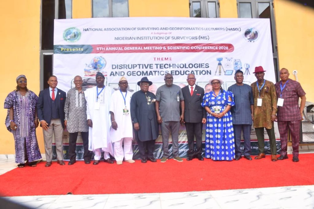
The National Association of Surveying and Geoinformatics Lecturers (NASGL) has challenged Nigerian universities to urgently modernise geomatics education as artificial intelligence (AI), drones, machine learning, LiDAR, satellite constellations and other disruptive technologies reshape the surveying profession.
The call was made at the opening of the 5th Annual General Meeting and Scientific Conference of NASGL, a subgroup of the Nigerian Institution of Surveyors (NIS), held on Thursday, September 3, 2026, at the Staff Development Centre, Rivers State University.
The theme of the conference was “Disruptive Technologies and Geomatics Education”.
Declaring the Conference open, the Vice-Chancellor of Rivers State University, Prof. Isaac Zeb-Obipi, welcomed participants and described the conference as an important intellectual engagement, reaffirming the university’s commitment to advancing surveying and geomatics education.
The Vice-Chancellor who was represented by the Deputy Vice-Chancellor, Academic, Prof. Richard N. Amadi, disclosed that the university had recently approved a nomenclature change for the relevant department to better align it with contemporary professional and industry standards, stressing that the conference was a serious intellectual platform capable of contributing to national development.
The Chairman of the Occasion and Chairman of the Board of Fellows, Surv. Alabo C. D. Charles, JP, FNIS, PPNIS, said surveying had always evolved with technology, moving from traditional instruments and manual processes to digital mapping, satellite remote sensing and Global Navigation Satellite Systems (GNSS).
He said the current technological wave was different in scale because AI, machine learning, LiDAR, digital twins, robotics and other emerging technologies were fundamentally changing how surveying and geospatial professionals work.
He urged stakeholders to approach technological advancement with preparedness, strategic thinking and continuous learning, noting that previous innovations such as GNSS and Geographic Information Systems (GIS) had expanded rather than eliminated the profession.
The NASGL National Chairman, Dr Y. D. Opaluwa, MNIS, called for greater unity and collaboration among lecturers and professionals to confront the rapid technological transformation of the geomatics sector.
He stressed that educators must go beyond teaching existing techniques and prepare students for emerging technologies and professional demands, while strengthening geomatics education, research and professional practice.
Delivering the keynote address, former Vice-Chancellor of Rivers State University, Prof. B. B. Fakae, said disruptive technologies were fundamentally transforming geomatics, geodesy and related geospatial disciplines.
He identified AI and machine learning, drones and Unmanned Aircraft Systems (UAS), satellite mega-constellations, cloud computing, Big Data, blockchain applications for land records and Augmented and Virtual Reality as technologies reshaping the acquisition, processing and application of geospatial information.
Prof. Fakae warned that universities risk producing graduates whose skills no longer meet industry expectations if they fail to deliberately respond to the technological revolution.
He identified outdated curricula, inadequate access to modern hardware and software, weak academia-industry collaboration, insufficient research funding, slow adoption of digital teaching systems and the widening gap between graduate competencies and employer expectations as major challenges.
He called for continuous curriculum modernisation, competency-based education, digital learning systems, stronger industry participation in university training, continuous professional development for lecturers and geospatial innovation hubs to support research, entrepreneurship and technology development.
Prof. Fakae also described geomatics education as a strategic national investment, noting that many of Nigeria’s challenges, including urbanisation, climate change, land administration, infrastructure development, agriculture and national security, have strong spatial dimensions.
He urged NASGL and other stakeholders to lead the transformation of geomatics education and equip graduates not only to understand emerging technologies but also to innovate and apply them to real-world national challenges.
Representing the Special Guest of Honour and President of the Nigerian Institution of Surveyors, Surv. P. C. Eze, FNIS, the Vice President, Academic and Professional Issues, Surv. Prof. Gertrude Nnanjar Njar, said the profession was rapidly moving from analogue mapping to real-time and automated data collection and analysis.
The President identified GeoAI, machine learning, autonomous UAVs, mobile LiDAR and nano-satellite constellations as technologies redefining surveying and geospatial practice, adding that professionals were increasingly shifting from manual data collection towards data analysis, management, software-driven processes and geospatial data science.
The President of the Surveyors Council of Nigeria (SURCON), Surv. M. O. Akinwande, FNIS, in his special remarks, commended Rivers State University and the academic community for hosting the gathering.
He recalled policy developments that have enabled lecturers to engage in professional practice, describing the development as an important bridge between academic knowledge and practical field experience.
Chairman, Local Organising Committee, Dr Godwill T. Pepple, welcomed delegates to Rivers State University and said the gathering would promote knowledge exchange, professional relationships and practical strategies for advancing geomatics education.
NASGL Rivers State Chairman, Dr K. P. Jackson, MNIS, described the conference as a significant gathering of academics and professionals and urged participants to generate ideas capable of strengthening education, research and practice.
SURCON President, Surv. M. O. Akinwande, FNIS, called for technology to be embraced as an opportunity while maintaining professional identity, standards, regulation and the foundational principles of surveying.